

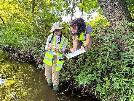
PRWC launched its bacteria and nitrate monitoring program in 2019. Nitrogen is an indicator of fertilizer runoff, septic failure, and animal waste. Nitrogen is also a contaminant of major concern for Long Island Sound (fed by all the rivers and streams throughout Connecticut). We sample for nitrate as an indicator for total nitrogen. E. coli bacteria serves as an indicator of general water quality degradation from septic effluent and agricultural runoff, which are the main sources of pollution in the Pomperaug River Watershed.
The goal of PRWC’s bacteria and nitrate monitoring is to establish an updated baseline of water quality conditions near sites targeted for the future implementation of best management practices (BMP) identified in our Watershed Based Plan. The Plan addresses stream impairments identified in DEEP’s Biannual Water Quality Report to Congress through the implementation of BMPs (conservation projects designed to reduce non-point source pollutant loading to the Pomperaug River and its tributaries).
The data we collect from our E. coli bacteria and nitrate monitoring program helps us to identify problem areas in the watershed where non-point source pollution and stormwater runoff reduction projects, such as rain gardens or riparian buffers, can be implemented to improve water quality.
Interested in getting involved? Come sample with us!
Active Monitoring Sites (2026)
Bullet Hill Brook, Ewald Park, Southbury
East Meadow Brook, Strong Meadow Preserve, Woodbury
Good Hill Brook, Grassy Hill Road, Woodbury
Lewis Atwood Brook, Lynns Corner Road, Woodbury
Nonnewaug River, Quassuk Road, Woodbury
Nonnewaug River, Falls Road, Bethlehem
Pomperaug River, Judson Avenue, Woodbury
Pomperaug River, Flood Bridge Road, Southbury
Pomperaug River, Poverty Road, Southbury
Pomperaug River, S. Pomperaug Avenue, Woodbury
Pomperaug River, Oakdale Manor Road, Southbury
Sawmill Brook, Rowley Road, Woodbury
South Brook, Middle Quarter Road, Woodbury
Sprain Brook, Papermill Road, Woodbury
Click link above for full screen map.
Map may not properly show in all browsers.
This map shows locations tested for Escherichia coli (E. coli) bacteria. Users can click on the site to view more information about the monitoring location, including stream name, description of the site, town, as well as the bacteria, nitrate, and conductivity level at the time the water sample was collected. E. coli data are reported as "colony forming units per 100 mL" of water (or CFU / 100mL)
The different colored icons and bacteria ranges represent risk thresholds, which are based on the statistical chances of getting sick if you come in contact with water in these bacteria ranges. We test for E. coli, a bacterium that is found in the guts of all warm-blooded animals, including humans. Most E. coli will not cause illness. We test for E. coli because it is often an indicator for the presence of other, more difficult to test for pathogens that may cause waterborne illnesses to those swimming, wading, or boating.
Here's how to interpret the data presented:
RED DOT
(>575 CFU / 100 mL)
Unsafe for Swimming, Boating, Fishing, Wading
YELLOW DOT
(>235 to 575 CFU / 100 mL)
Safe for Boating & Fishing (minimal water contact);
Not safe for Swimming
NOTE: Indicator bacteria levels can change dramatically from day to day. Therefore, this information is a snapshot of river conditions at the moment the sample was taken. To best understand the water cleanliness in terms supporting safe recreation, open each sample location’s page for more detail and historical data showing trends in water cleanliness. Be sure to take the most recent sample date into account as well as patterns over time, recent weather, and flow conditions when deciding whether to swim, wade, fish, or boat. You can also view these data by turning the various layers on and off for each sampling event. The layer turned on highest up in the list of layers available will the one visible.
In general, bacteria levels are typically elevated during and shortly after precipitation events (wet weather). Good precautions to take include:
-
Avoid swimming right after a rain storm where runoff is generated (> 0.1" rain)
-
Avoid contact with the river downstream of a sewage discharge
-
Cover open cuts, use ear and nose plugs
-
Wash hands before eating or drinking
Also remember, rivers are inherently risky environments for recreation due to variable streamflow (velocity), depth, substrate, and other hazards. Always be sure to share your recreation plan before you go out in/on the water.
We wish you a fun and safe season enjoying your rivers!
GREEN DOT
(0 to 235 CFU / 100 mL)
Safe for Swimming, Boating, Fishing, and Wading
Summary of Findings (2019 to 2022)
Appendix A - Quality Assurance Project Plan
Appendix B - Tabulated Results by Sample Site
Appendix C - Results & Summary Statistics Compared to CT
Water Quality Standards
Appendix D - Raw Data: Field Data Sheets, Chain of Custody Forms,
Laboratory Reports
Monitoring Protocol:
Stream Sample Collection Protocol & EpiCollect App User Manual
